
Augmented Proximity in Urban Network for Visitor Mobility: A Conceptual Proposal and Application to Cities
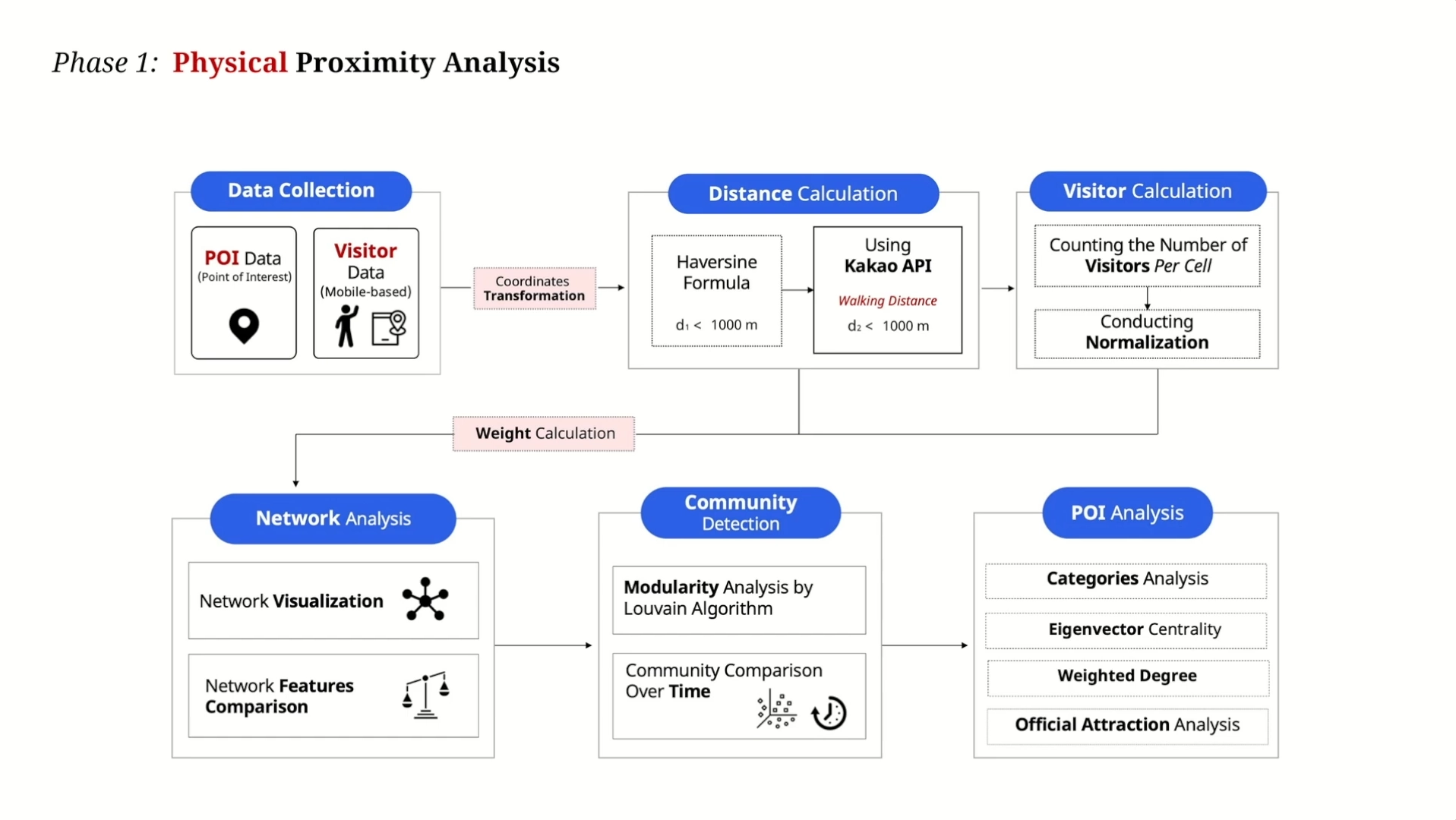
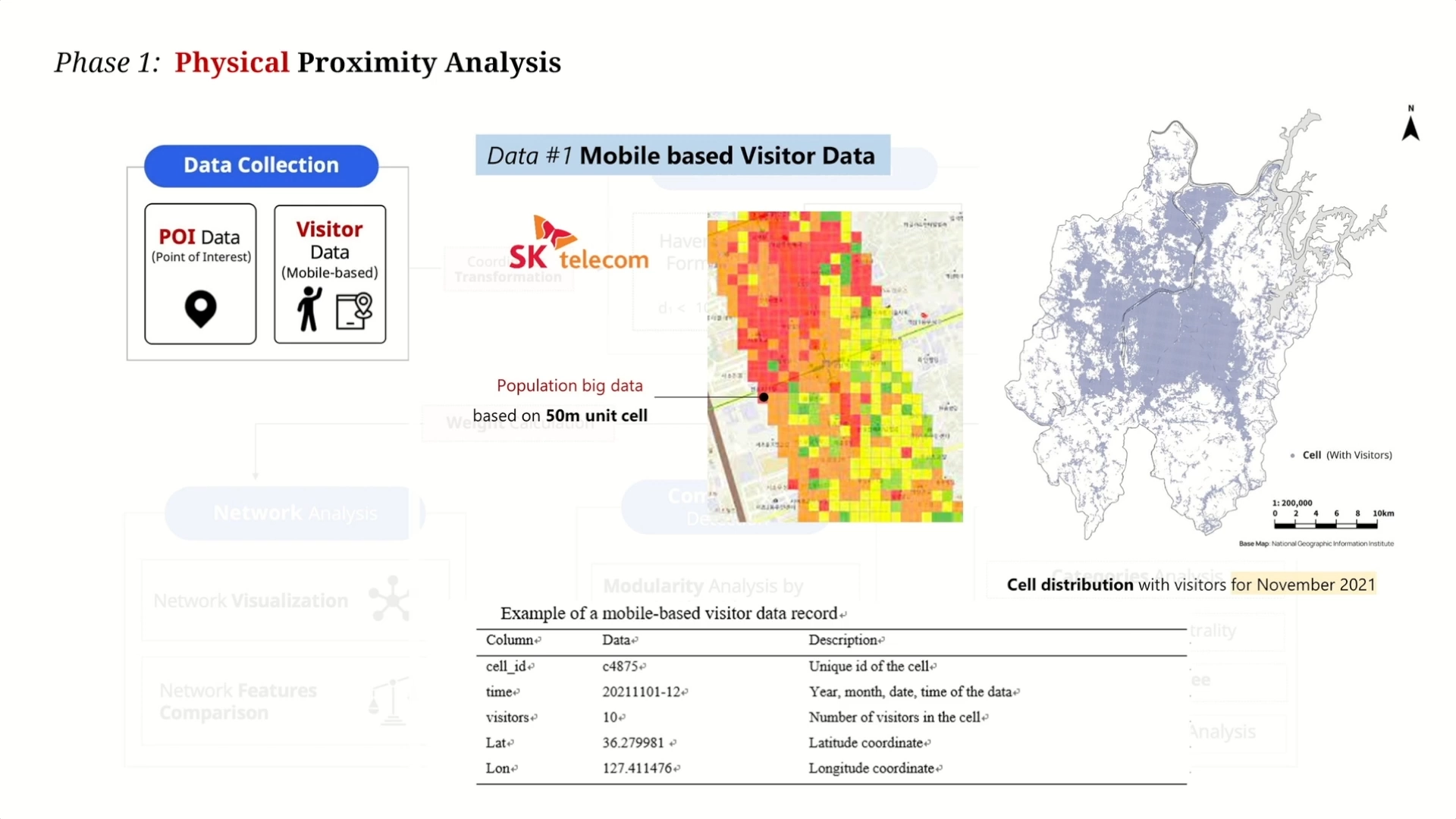
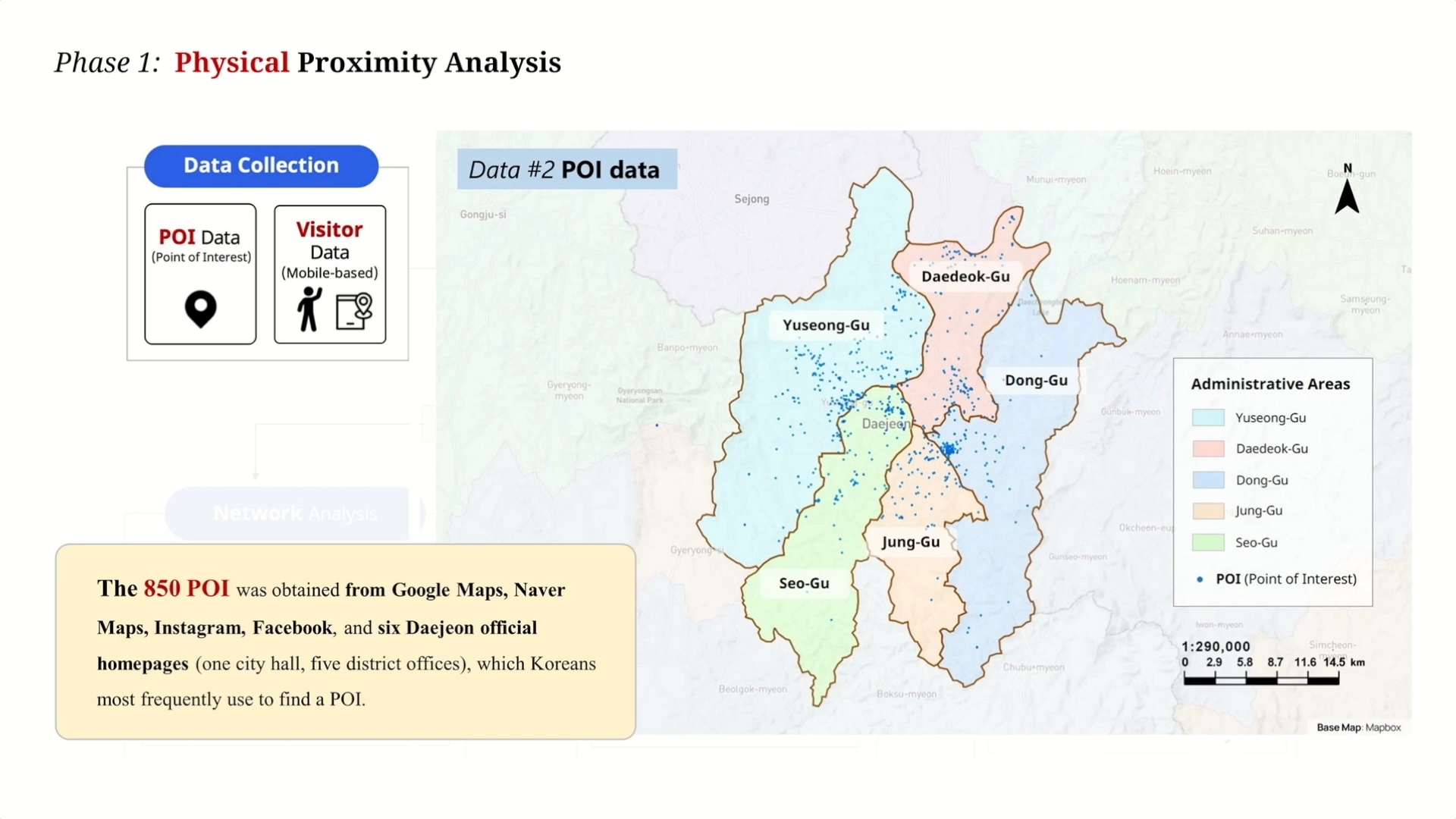
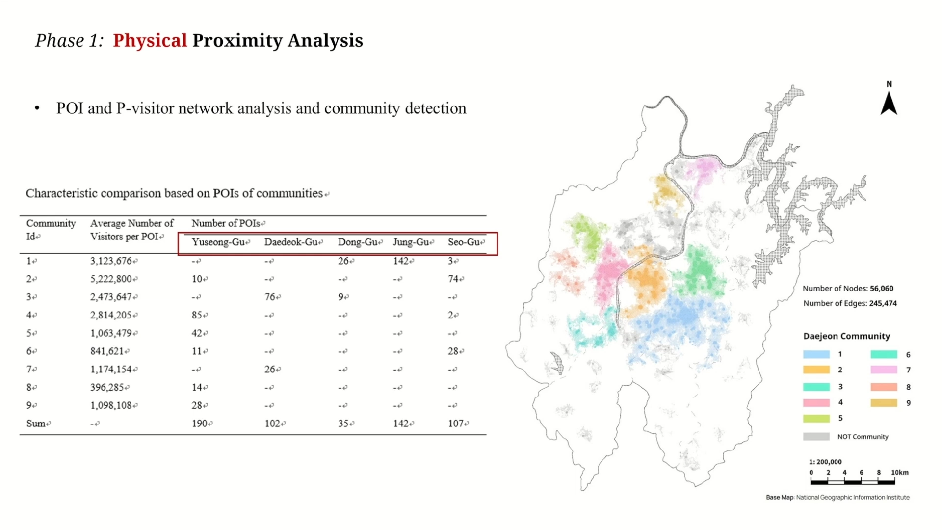
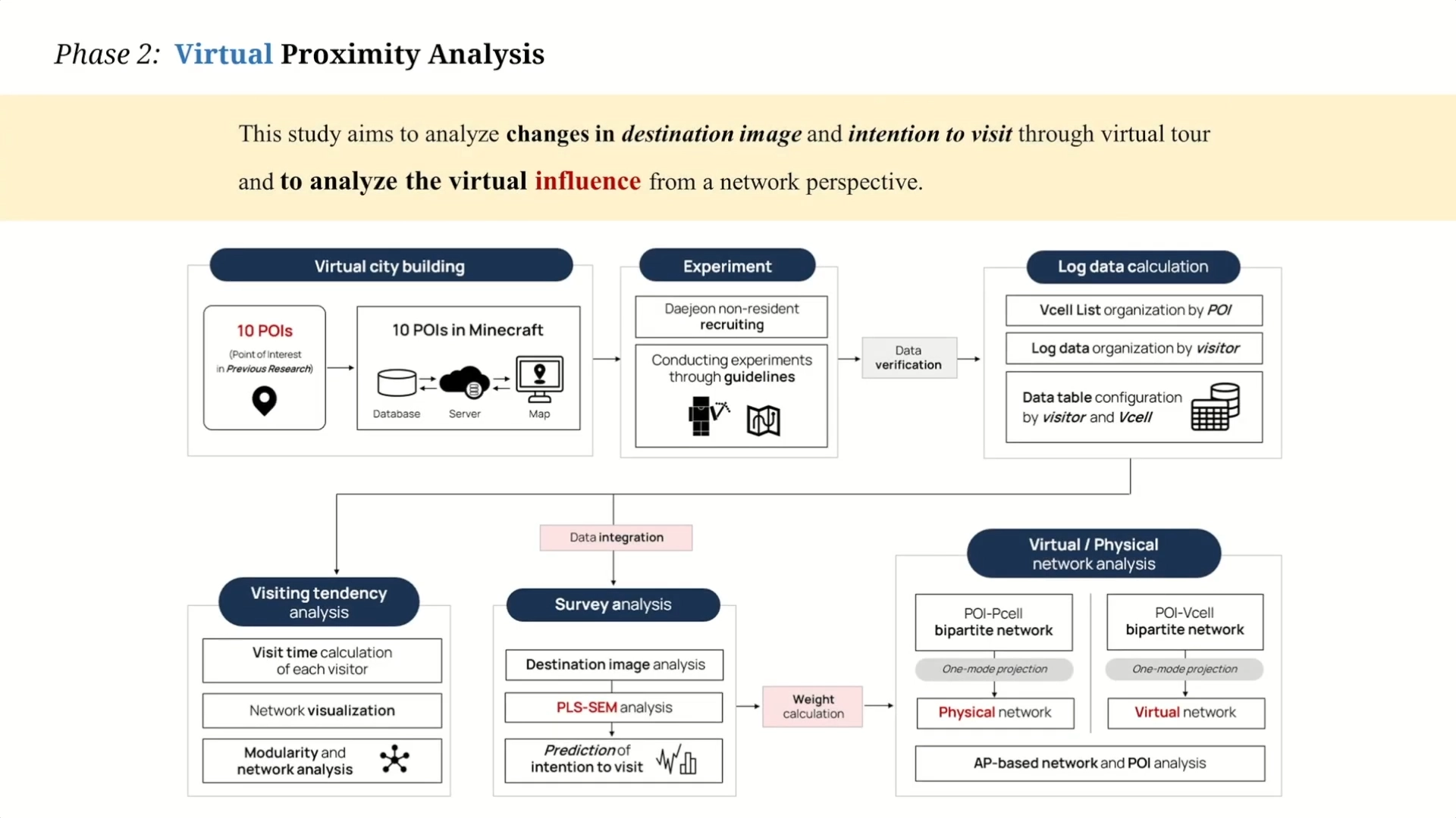
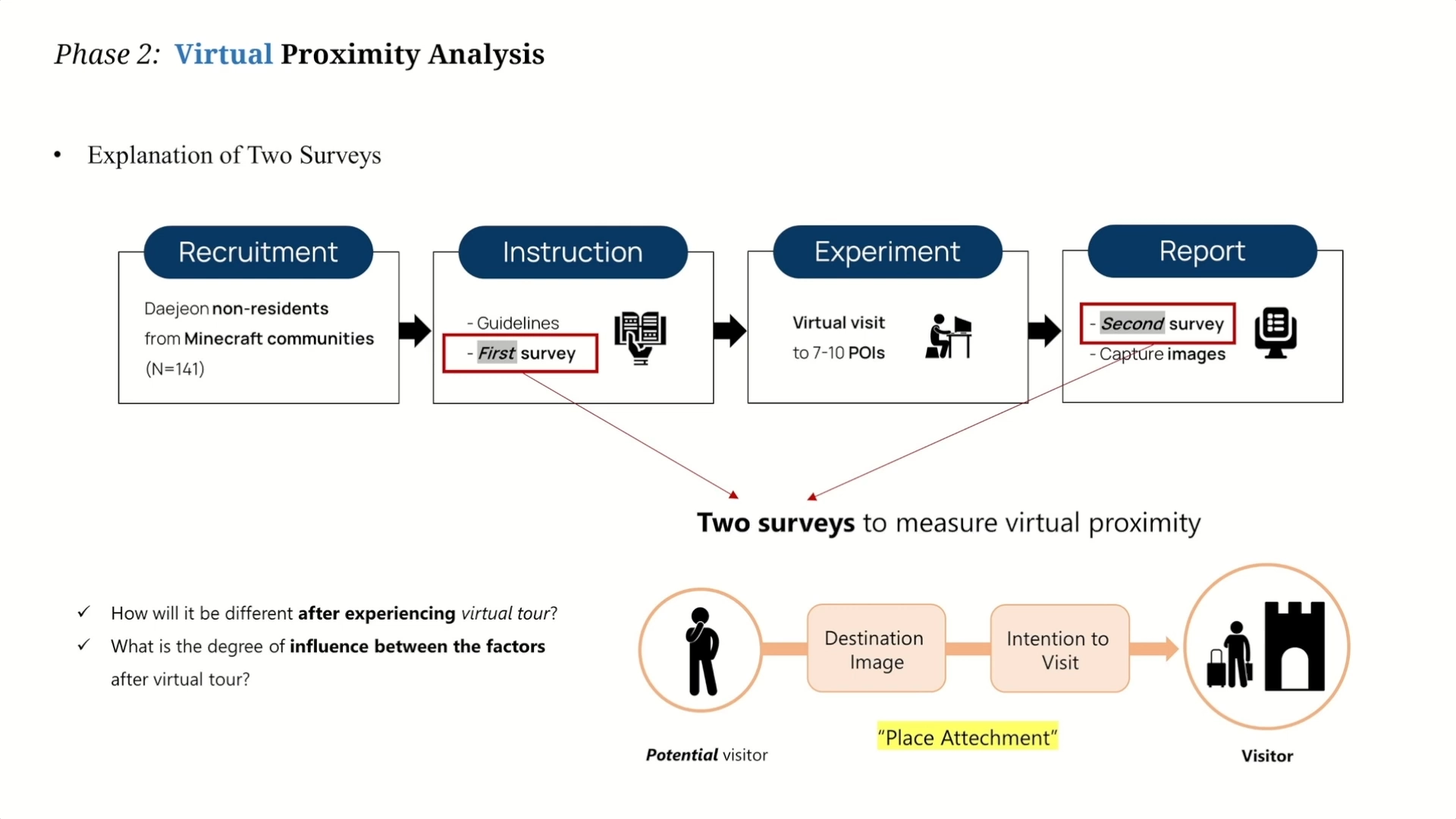
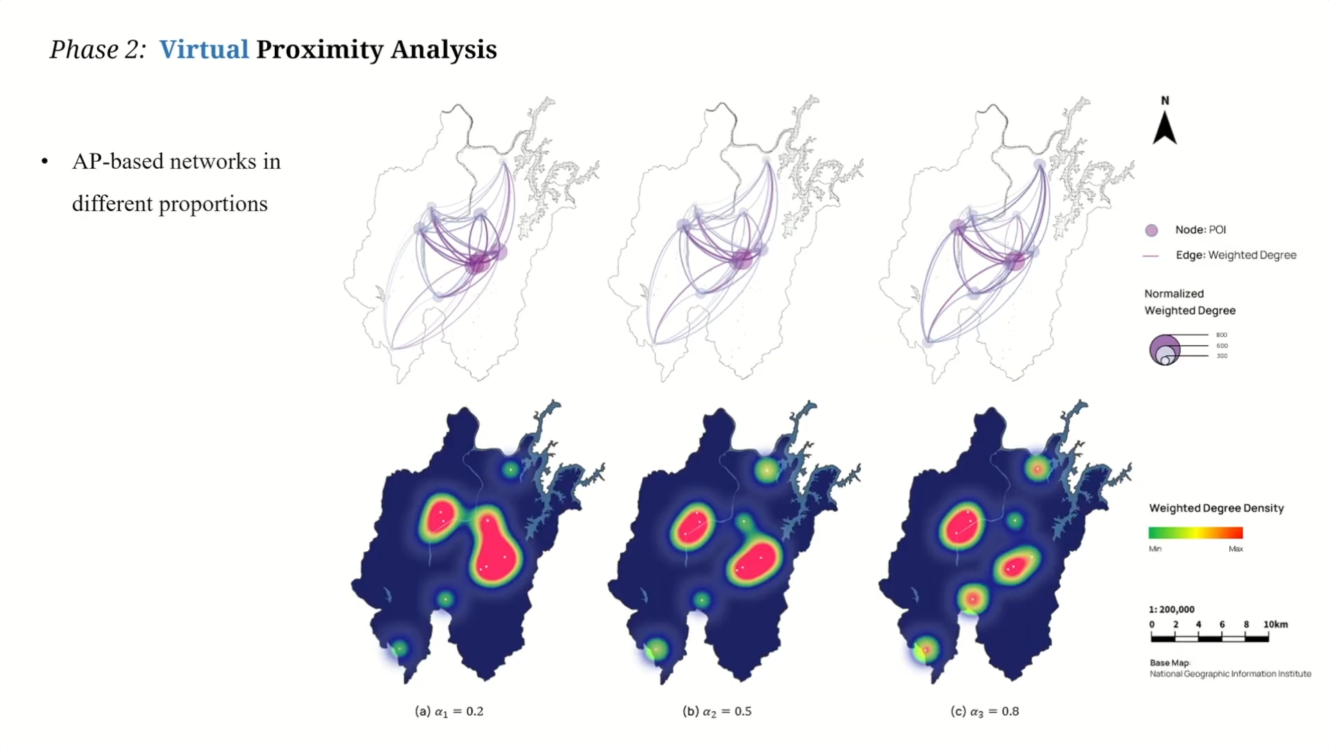
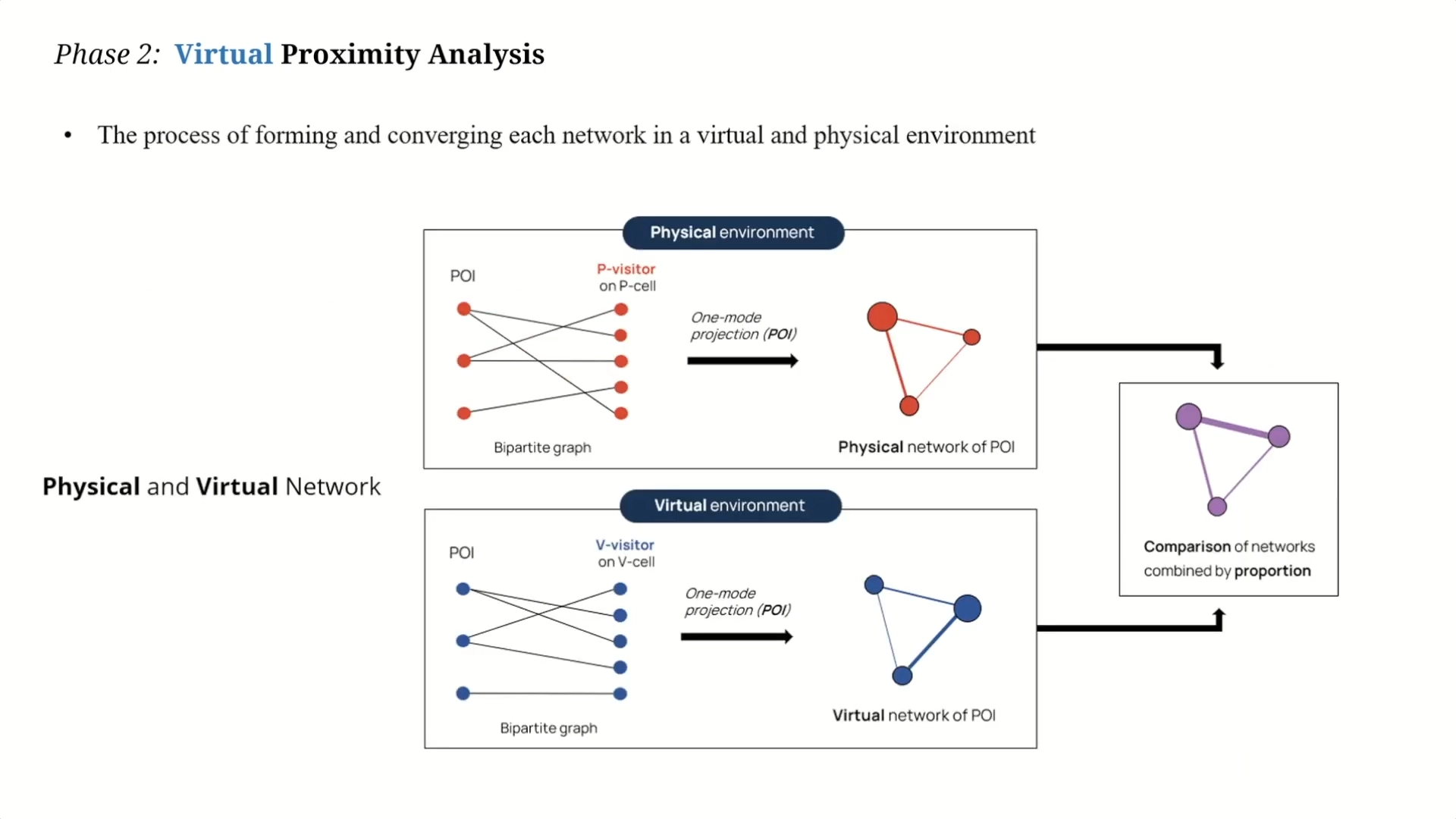
Cities create different local contexts through various networks created by human and non-human elements. City network analysis is used to analyze the mobility of various users, including city visitors, and to understand the space. However, existing studies have limitations in three respects. The first is that comparative indicators are limited for the proximity of cities that are being virtualized, such as smart cities and digital twins. Second, there needs to be more research on spatial patterns considering both physical and virtual environments regarding urban connectivity. Finally, even if the problem of intra-city movement is found, connecting to a user-centered rather than a technology-centered solution is not easy. In this dissertation, two stages were conducted to study the city to overcome the above three limitations. First, we defined Augmented Proximity (AP) considering physical and virtual proximity simultaneously and developed an index to compare applications such as area-based platforms implemented based on this. This concept comes from Mixed Reality (MR) and has the property of a continuum where physical and virtual proximity coexists. Second, a practical plan to understand the regional context through augmented proximity-based network analysis and overcome the physical limitations of city visitors was also established. The first experiment was conducted using the campus as a living lap, and the local context was first understood through spacial networks, and services were applied. Extending this analysis to the city, a secondary study was conducted targeting 850 POIs (Points of Interest) in Daejeon Metropolitan City, which many visitors visit. Pedestrian center physical proximity was analyzed with actual visitor data (95,817) based on a 50-meter unit cell provided by SK Telecom. Among them, ten POIs were extracted and built in the Minecraft environment. We found that the user’s destination image of Daejeon and intention to visit Daejeon were improved, and the degree of attachment to Daejeon, that is, virtual proximity, increased. This study proposed augmented proximity, a new concept that considers physical and virtual proximity and proposed an indicator to compare services or platforms to augmented proximity-based networks. In addition, for areas with low physical proximity, a virtual solution with a new perspective that can overcome physical limitations was provided through a plan to activate visits.
Publications
Chang, M., Lee, G. & Lee, J.-H. (2023). Analysis of Urban Walkability based on Mobile Data: The Case of Daejeon, Korea. Cities (minor revision). SSCI (IF=6.077)
Chang, M., Lee, G., Lee, J., Lee, J. & Lee, J.-H. (2023). The Influence of Virtual Tour on Urban Visitor using a Network Approach. Advanced Engineering Informatics. (minor revision) (IF=7.862)